

Our project is based in the state of Assam, India
The blue area on the map is the Margherita subdivision of Tinsukia district, where most of our work is done. The green area represents the areas where the Ahoms live, and the pink shows the Turung (Singpho speaking) and Aiton (Tai speaking) villages.
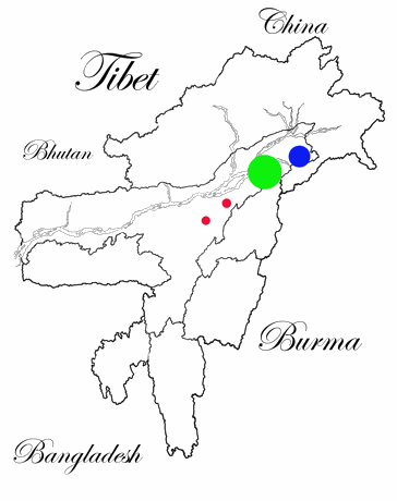
Map 1
Map 2 gives a closer picture of the Margherita area, and shows how close villages of different communities are to each other. The tribal people in Margherita make up perhaps 10-15% of the population of the subdivision outside of the town. In recent years large numbers of Nepalis, Biharis, Adivasis (tea labourers), Muslims and others have moved to this area. The Tribal communities are no longer the majority in the plains areas, though they may still be a majority in the hill areas.
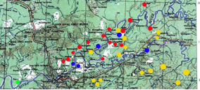
Map 2
showing Margherita town, with
Tai Phake villages (blue)
Singpho villages (red)
Tangsa villages (yellow)