


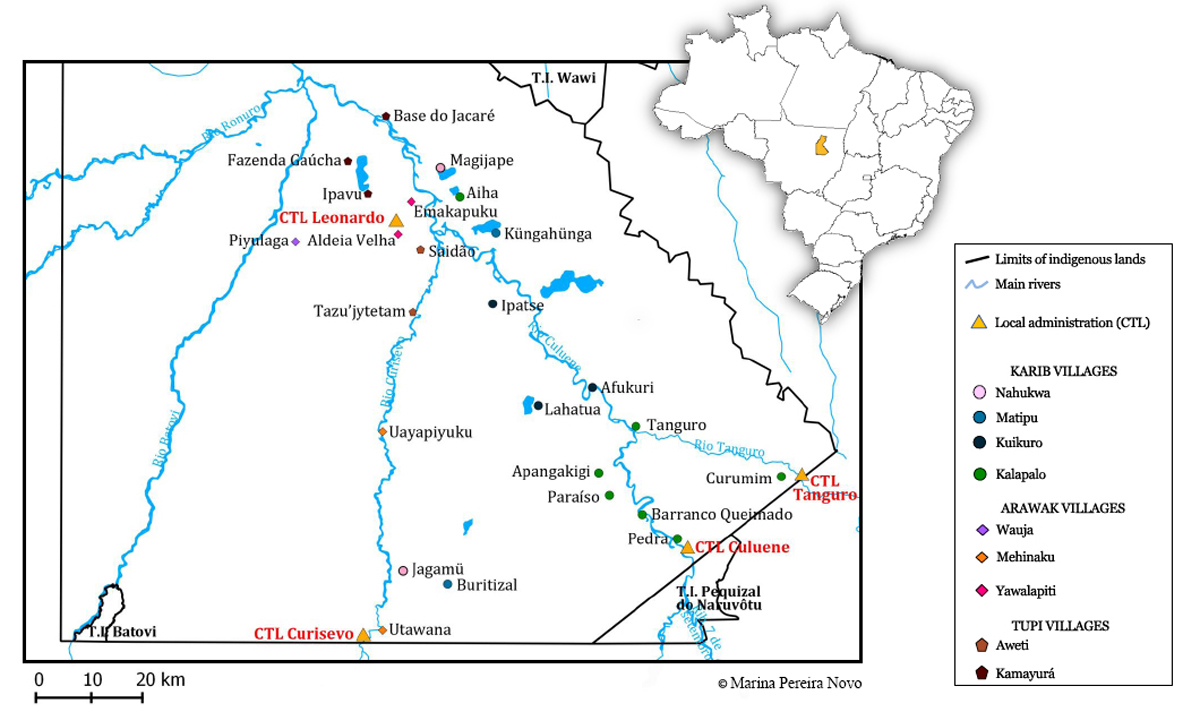
The Upper Xingú, southeast of the Xingú Indigenous Land, State of Mato Grosso (Brazil)
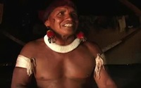
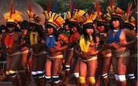
The Kuikúro are part of the sub-system formed by the Carib speaking Upper Xingú groups. The headwater region of the Xingú River, a major southern tributary of the Amazon, is known as the ‘Upper Xingú’ and constitutes an ecological, cultural and political unit. Since 1968 it has been part of the Indian Reservation named the ‘Xingú Indigenous Land’, in the Brazilian State of Mato Grosso, covering an area of about 22.000 square kilometres.
The Upper Xingú is a “large tongue of forested land protruding into the savannah, transitional between the equatorial Amazon lowland forest and the tropical central Brazilian forest” (Heckenberger, 1996). It can be generally characterized as a peneplain surrounded to the south, east and west by topographic highs. The Xingú River is formed by the meeting of the rivers Steinen, Ronúro, Batoví, Culiséu and Culuéne, from west to east. These rivers are subject to a period of flooding during the rainy season (from October to May) and have wide meanders within their floodplains. The Kuikúro and the other Upper Xingú Carib groups live along the Culuéne and Culiséu Rivers.

Aerial photos of the Culuene River with its meanders and floodplains (Bruna Franchetto, 2001)
The Upper Xingú basin is characterized by a mosaic of distinct ecological zones where the bio-diversity is remarkable, matching that found throughout other Amazonian regions.
Recent archaeological studies in the Kuikúro territory have provided important new data showing that “the Amazon forest is not in a stage of natural equilibrium, disrupted by human intervention, but instead the product of a dynamic interaction between large, settled human (native) populations and nature” (Heckenberger et al., 2003). This interaction began at latest at the end of the first millennium.
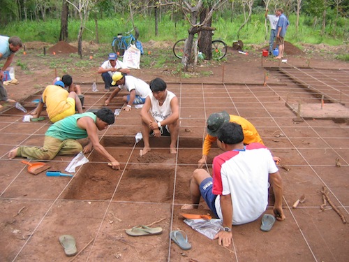
The archaeological team, conducted by Michael Heckenberger, works near the village of Ipatse (2004)
Nowadays, the indigenous reservation, called “Terra Indígena do Xingú”, is surrounded in all directions and along its entire perimeter by farm land and extensive deforestation.
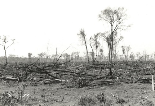
Deforestation on the way to the Culuene river, traditional Carib territory, outside the Southeastern border of the Xingú Indigenous Land (Photo Bruna Franchetto 2001)
References
Heckenberger, M. J.
1996 War and Peace in the Shadow of the Empire: Sociopolitical Change in the Upper Xingú of Southeastern, c.a. A.D. 1400 – 2000. PhD dissertation, University of Pittsburgh, Pitsburgh, University Microfilma, Ann Arbor.
Heckenberger M. J., Ahukaka Kuikuro, Urissapá Tabata Kuikuro, J. C. Russel, M. Schmidt, C. Fausto, B. Franchetto.
2003. “Amazonia 1492: Pristine Forest or Cultural Parkland?” Science 301: 1710-1714.
Heckenberger M. J., Russel J. Ch., Fausto C., Toney J.R., Schmidt M J., Pereira E., Franchetto, B., Kuikuro Afukaka.
2008. “Pre-Columbian Urbanism, Anthropogenic Landscapes and the future of the Amazon”. Science, 321: 1214-1216.